What is a Smart City and what does Smart City mean?
Techopedia explains ‘Smart City’
There is no definitive explanation of a smart city because of the breadth of the technologies that can be incorporated into a city in order for it to be considered a smart city. Mark Deakin defines it as a city that utilizes ICT to meet the demands of its citizens, and that community involvement in the processes is a necessity for a smart city.
From the definition given by Husam Al Waer and Mark Deakin in their research publication “From Intelligent to Smart Cities,” the factors that contribute to a city being classified as smart are:
- The application of a wide variety of digital and electronic technologies to the city and its communities
- The application of ICT to uplift life and the working environments in the region
- The embedding of such ICT within government systems
- The territorialization of practices that bring the people and ICT together in order to foster innovation and enhance the knowledge that they offer.
How smart cities and the Internet of Things (IOT) will reshape South Africa?
South Africa is in the midst of the fourth industrial revolution, in which the smart use of information and technology is reshaping societies. One of the most apparent examples is the growth of the Internet of Things (IoT), where smart, connected devices are being deployed in cities and industries globally to gather data to achieve higher levels of efficiency and productivity. South Africa is on par with the rest of the world – with many initiatives already being addressed in Cape Town, Johannesburg, Pretoria, Durban, and Port Elizabeth.
Cities globally have common objectives regarding the safety, healthcare, and education of their communities, as well as the delivery of services in the form of utilities and transportation networks. The growth of ICT is enabling cities to better meet these objectives, allowing for smart solutions that aim at developing the urban ecosystem while managing assets and resources efficiently.
If South Africa wants to remain the gateway to Africa, our cities, the services we provide and the lifestyle we create for citizens must be nothing less than the global standard set by leading cities around the world. Considering the predicted growth of the continent, it is easy to see why developing smart cities in South Africa now is not only a necessity but also a smart investment in the country’s future.
How Geotab’s Smart City Insights can help the future of transportation in South Africa an so much more
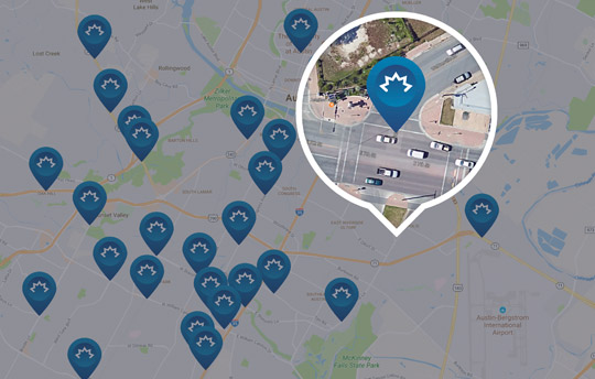
Geotab processes over 2 billion data points per day. These data points contain rich information that can be analysed to generate Smart City insights. Geotab’s data scientists extract these insights for consumption by municipalities, and for city leaders, this means real-time visibility to their city operations:
Road Conditions:

Automatically identify potholes and other poor road conditions using Geotab’s road conditions dataset. Aggregated vertical axis accelerometer data is analysed in near real-time to indicate areas in need of road maintenance/repair. This data can be integrated directly into a city’s public works and/or road maintenance departments for automated dispatching and work orders.
Traffic Flow:

Determine the average speed on all your city roads throughout the day. Identify traffic bottlenecks and/ or road segments where excessive speeding may be an issue. Monitor the effects of new signage and/or traffic-light scheduling in near real-time. Optimize traffic flow during the construction seasons and other traffic disturbances.
Dangerous Roadways/Intersections:
Take action on road safety. Identify the most dangerous roadways in your city. Discover hazardous intersections and/or road conditions that result in accidents or near-misses. Engage with your citizens to reduce dangerous driving behaviours and reroute pedestrian pathways to avoid dangerous areas.
Roadside Weather:

Gain insight into hyper local roadside weather conditions on all your major roadways. Identify potential black ice conditions or high temperature areas that could lead to concrete buckling or cracking. Proactively notify your citizens of dangerous road conditions in near real-time.
With our innovations and investment in technologies, we developed an open platform you can build on for Smart Cities, which is compatible with various devices and supports a wide range of IOX applications. We aim to be the rich soil that supports the robust and sustainable development of Smart Cities. We will continue to work together with our partners to create A Device Like No Other addressing solutions for any Industry needs and achieving the ultimate goals of a Smart City – to enable good data governance, promote industry development and deliver benefits for communities.
Author: Ricardo Labans, National Technical Supervisor – Geotab Africa
Download our industry-specific brochures:
Construction Vertical Brochure| Courier and Delivery Vertical Brochure | Field Sales & Services Vertical Brochure | Food and Beverage Vertical Brochure | Government Vertical Brochure | Mobility Transport Vertical Brochure | Oil Gas & Mining Vertical Brochure | Police and First Responder Vertical Brochure | Towing Vertical Brochure | Transportation and logistic Vertical Brochure | Utilities Vertical Brochure