Geotab’s focus is to help companies and fleet managers ease their fleet management by providing them with significant measures on safety, efficiency, productivity and compliance.
This is why we offer many features through the MyGeotab software, including a MyGeotab map tool to help fleets track their performance more accurately and effectively by allowing them to access vehicle status, create zones, view travel history, and track driver behaviour.
How to Benefit from the MyGeotab Map

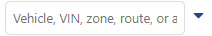
1. You Can Search for your Vehicles
The MyGeotab Map was created to help users view the current and historical location of their vehicles. Users can search their vehicles by entering the vehicle’s registration number, name, VIN number, route, or zone. Moreover, users can view all their vehicles at once, make multiple selections, or view one vehicle at a time.
2. You Can Add Zones
Adding zones on the MyGeotab Map is like creating a safe house for your vehicles. This is because zones are designed to buffer your vehicle’s correct position and enable fleet managers to identify customer’s sites or property. Therefore, when creating a zone, it is important to apply different colours to each zone so they can look different. Some of the places that can be listed as zones include business premises, corporate sights, and private properties.
Also, every zone needs to have a name. For instance, you could name your own business premises as “My Property”. This can be the place where all your vehicles will be parked. You can also assign vehicles to a certain zone for you to know where a specific vehicle should be.

Finally, there are 3 types of shapes on the MyGeotab Map which show whether the vehicle is mobile (triangle), parked off in a zone (star), or is elsewhere (square). As shown on the image below, the vehicle is parked in the zone and it can be well considered as safe.

Read more on how to create zones.
3. You Can View Your Vehicles Trip History on the MyGeotab Map
Receiving historical data of your vehicle’s activities is essential. The MyGeotab map can provide you with the correct information about past locations of vehicles, including their exact time, position and events. This will help you identify the time spent at the office, at the client, and how many times a particular vehicle has visited a particular location.

The events that can be viewed include any kind of exception like overspending, harsh braking, accidents, idling and after hour movement. All this data can be exported to any preferred type of sheet, like Microsoft Excel.
Read more on the Excel Tips for Fleet Reporting.
4. Other Functions Available on the MyGeotab Map
MyGeotab Map gives users an opportunity to experience different ideas of using a map to ease its utility. Through the map, you are able to view road speeds and road names. This feature can help you set up speeding exceptions and compare your vehicles live speeds with the ones on the map.

Author: Tisetso Tsosane, Control Room Operator – Geotab Africa
Download our industry-specific brochures:
Construction Vertical Brochure| Courier and Delivery Vertical Brochure | Field Sales & Services Vertical Brochure | Food and Beverage Vertical Brochure | Government Vertical Brochure | Mobility Transport Vertical Brochure | Oil Gas & Mining Vertical Brochure | Police and First Responder Vertical Brochure | Towing Vertical Brochure | Transportation and logistic Vertical Brochure | Utilities Vertical Brochure